Connecting the Dots
Using data to engineer smarter urban spaces
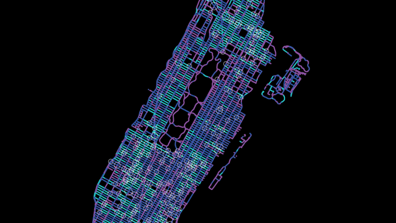
By partnering with NYDOT, Andrew Smyth and his doctoral student Patrick Alrassy captured a unique data set enabling them to map dangerous intersections and other obstacles to traffic flow. (Image courtesy of Patrick Alrassy)
Sensors that automatically transmit air, soil, and water conditions to smartphone apps; busy intersections connected to a local, cloud-enabled, deep learning system for coordinating pedestrian and autonomous vehicle traffic; a new formula for producing cement that significantly cuts greenhouse gas emissions. Increasingly, our crowded urban areas will require blue-sky visions like these to render them more livable, sustainable, and climate-resilient. Or, in other words, smart.
Though the phrase “smart city” entered our lexicon about a decade ago, the concept is still very much evolving. At its simplest, it employs the Internet of Things (IoT) to optimize urban services. But implementing clever tools for harnessing ever more data isn’t enough, says Civil Engineering Professor Andrew Smyth—to be truly smart, cities must integrate technology with an eye to the greater good. “It takes thoughtful engineering to ensure that these initiatives directly support societal benefits,” he says. “At Columbia, we’re looking for ways to serve neighborhood groups, industry, municipalities, and individual citizens.”
By midcentury, “urban citizen” will define most of us. More than two-thirds of the global population will soon live in urban areas—which account for 70 percent of the world’s CO2 emissions, and where aging infrastructure is often already overtaxed, even as huge technological shifts are rewiring how people and machines circulate through these densely builtup landscapes. With keen insight into what’s coming, Columbia engineers—in collaboration with dozens of colleagues from Columbia University’s Data Science Institute (DSI); Earth Institute (EI); and multiple University departments, schools, and units, as well as outside collaborators—are busy laying the experimental groundwork for a smarter approach to smart cities.
Such retrofitting for our new reality requires more than a little creative thinking. “Investments in civil infrastructure are massive, and you can’t change those overnight,” acknowledges Smyth, who also chairs Columbia’s DSI Smart Cities Center. “But you can change how they’re used. New York City has been receptive to new technologies. As complex as it is in NYC, if we can do it here, we can do it anywhere.”
Smarter Cities = Safer Streets
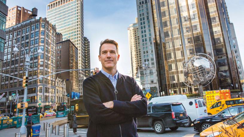
Andrew Smyth (Photo by Timothy Lee Photographers)
Investments in civil infrastructure are massive, and you can’t change those overnight. But you can change how they’re used… As complex as it is in NYC, if we can do it here, we can do it anywhere.
Using a global capital as a laboratory is a tremendous opportunity, as evidenced by an NYC–Columbia Engineering partnership focused on safer streets. The brainchild of Smyth and his doctoral students, this project involves vehicle telematics and a data management system that calculates a “driver behavior index.” City vehicles, other than police cars and garbage trucks, have been outfitted with transmitters that record anomalous events, such as when a driver brakes sharply. When patterns emerge, a map-matching technique developed by the team is able to clean the noisy GPS data endemic to building-dense cities and locate the trouble spot, whether it’s a dangerous intersection or a deep pothole. Besides already helping with prudent road and traffic design, says Smyth, “The system provides the first hard data at a large scale to corroborate intuitive beliefs like ‘high speed causes more crashes on city streets.’”
In an unintended benefit, they also uncovered dozens of mistakes in commercially available mapping tools, including roads that ran in an opposite direction from what was indicated—a time-wasting mistake for an ambulance rushing to the hospital. “It’s a unique data set,” Smyth says. “Analyzing fleet data to assess road networks will probably become a more common technique.”
As this type of fleet monitoring becomes standard operating procedure across the board, data gleaned from these roving bands of real-time sensors could enable a range of new applications. Take the conundrum posed by wildly popular delivery services—on the one hand they can save us precious hours trolling department stores and supermarket aisles; on the other hand their vehicles often resort to double-parking while unloading, clogging streets and pushing bicyclists into the flow of traffic. If researchers could precisely track delivery vans making their rounds, they might be able to create a “dynamic parking” system that seamlessly choreographs drop-offs down to the minute.
In the right hands, however, a traffic sensor becomes much more than a traffic sensor—it becomes one more tool to foster holistically intelligent streetscapes. That’s the animating idea behind ACCESS (Advancing Communications and Computing on Emerging StreetScapes), a collaborative project with NYU, Cornell Tech, Florida Atlantic University, and Rutgers University that aims to blend sensor data with millimeter-wave radar, machine vision, sophisticated probability, human behavior modeling, and local, or edge cloud, computing to improve life at hyper-local scales.
Of course, privacy issues are inevitable whenever movements and behavior are tracked, and ACCESS researchers are exploring ways to design safeguards into the system. “One solution we’re looking at is to keep the data at the neighborhood level, not in the cloud or a corporate data center somewhere—with perhaps an exception process for emergencies,” says Smyth, the group’s principal investigator (PI) and director. “We understand that ultimately the system will rely on the trust that communities will afford to the devices, entities, and software pipelines governing the acquisition of data and the decisions made that are based on that data.”
Smarter Cities = Healthier Environments
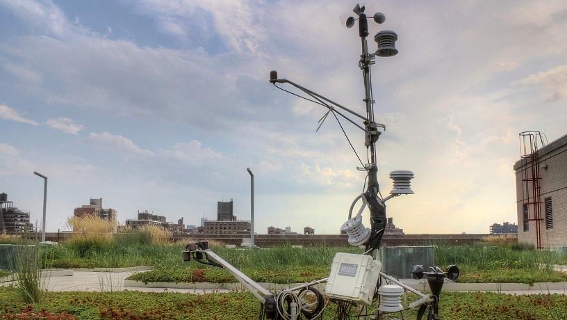
Patricia Culligan’s green roof project self-irrigates through stormwater runoff. (Photo by Daniel Marasco)
Cities are dynamic ecosystems, where humans interact with their environs in complex, interdependent ways. As co-PI on ACCESS, Civil Engineering Professor Patricia Culligan focuses on modeling strategies to address the environmental challenges of urbanization. In her work as a founding associate director of the DSI, she helps translate next-generation sensing and data informatics into healthier urban environments.
Recently, Culligan and her collaborators—who include DSI Founding Director and Computer Science Professor Kathy McKeown and Mechanical Engineering Professor Vijay Modi—completed a pilot project that provided intriguing insights on residential electrical consumption behavior. By using advanced monitoring systems coupled with machine learning and natural language processing, the team has not only gained a better understanding of the energy usage of individual apartment dwellers, but also devised ways to motivate them to use less—thereby helping city residents to cut emissions as well as save costs. By collecting and analyzing consumption data, then making individuals aware of their patterns, “We’ve found that, on average, people will decrease their consumption by 10 percent,” Culligan says. “However, by using smart ways to present consumption data, we can increase that number to 20 percent. The bottom line is that using a data-centric approach really makes a difference.”
You don’t create technology just to have technology. You create technology to serve people. Our school’s vision for smarter cities is one that aims to improve the lives of urban inhabitants.
Intelligent resource management isn’t just about data; it’s also about factoring in community wisdom. Leaving no stone unturned, Culligan is currently working with Electrical Engineering Professor John Kymissis to develop a low-power, wireless sensor network to monitor how urban soil health and engineered green infrastructure can improve a city’s environment through stormwater management and urban cooling. Taking a participatory, “citizen science” approach to creating healthier urban landscapes, the data will be collected through a smartphone app that people can use to monitor the health of their own neighborhoods. This bottom-up approach will help shape municipal practices on pollution, storm runoff, and other environmental concerns. “We’re only going to understand how to promote healthier city environments by combining data and statistical analysis with input from city residents,” she says.
In proper circumstances, however, IoT can take the work right off our hands. Culligan has also been working with her students and collaborators to advance the next generation of smart green infrastructure for urban cooling and stormwater management. In the Bronx, for instance, one smart green roof sensor-equipped IoT system collects runoff in a tank and uses it to irrigate the succulent plants covering the roof when their moisture level drops. The system is so smart, it checks the weather forecast to determine how big the next storm will be and empties its water tank in anticipation of the amount of rain expected. “We have shown that this IoT-enabled green roof system outperforms standard green roof systems,” says Culligan, “and thus has much promise when it comes to improving the environmental health of our cities.”
In addition to purpose-built IoT and sensor networks tailored for environmental monitoring, Smyth highlights the potential to leverage data collected by disparate sources. Take vehicle fleet telematics—the outdoor temperature readings and windshield wiper activity they capture can be correlated to provide highly accurate, real-time, localized information of urban microclimates. Because infrastructure density plays such a key role in the formation of heat islands, obtaining this kind of street-level detail opens up the potential of devising strategic interventions—shade trees, garden plots, pervious pavements, and cooling coatings on buildings—that not only beautify particularly hard-hit communities but also diminish instances of heat stroke and related health dangers.
Smarter Cities = Situationally Aware Vehicles
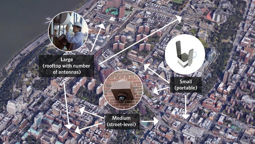
COSMOS integrates multi-size nodes operating at the rooftop, street, and personal/vehicle level, and will enable piloting smart intersection and cloud-assisted vehicle technology. (Courtesy of Gil Zussman)
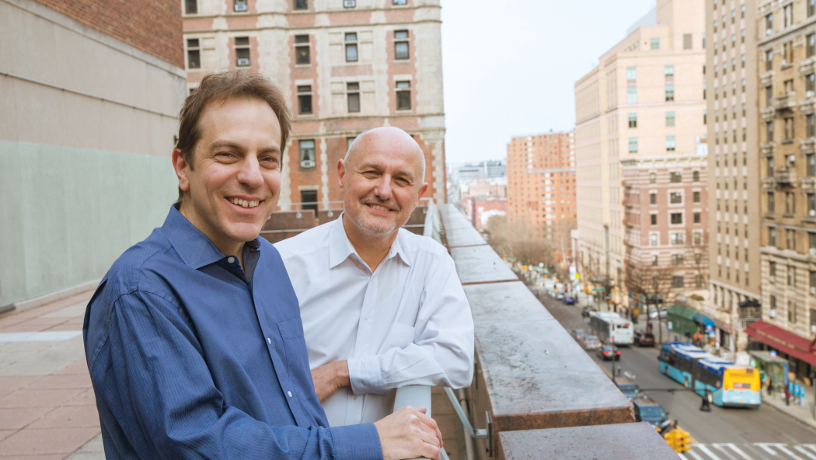
Gil Zussman and Zoran Kostic (Photo by Timothy Lee Photographers)
Underlying each of these applications is a central premise—the need for highly coordinated data collection from a huge network of widely distributed sensors. But with the advent of COSMOS—one of only two 5G-and-beyond testbeds currently being deployed in the United States—Columbia Engineering faculty are gaining access to an unprecedented outdoor lab. COSMOS enables not only more sophisticated analysis, but also new capabilities through performance enhancements such as millimeter-wave wireless communications, edge cloud computing, close integration of wireless and optical networks, and full-duplex radios that enable simultaneous two-way data transmission.
Occupying a square mile of Manhattan adjacent to Columbia’s Morningside campus, COSMOS is a National Science Foundation– funded effort composed of a consortium of universities, the local community, and industry. The initiative is led by Rutgers University, Columbia University, and New York University, plus the City of New York, Silicon Harlem, City College of New York, University of Arizona, and IBM.
According to Electrical Engineering Associate Professor Gil Zussman, Columbia’s PI on the project, the testbed’s infrastructure will include several large wireless nodes—or base stations— containing software-defined radios to be located on top of buildings such as Columbia Engineering’s current home in Mudd. About 40 medium-size nodes will be placed at street level at building sides or on light poles, and some 200 experimental mobile devices will be hooked into the network. Edge cloud computing—servers integrated into the wireless access network—will speed up the data processing and response time.
The project leverages the talents of several Columbia engineers, including Harish Krishnaswamy, associate professor of electrical engineering, and Henning Schulzrinne, a professor of computer science and electrical engineering. Electrical Engineering Associate Professor Zoran Kostic has tapped into COSMOS to study the busy intersection at 120th Street and Amsterdam Avenue. Here, Kostic is piloting technologies designed to enable the future of smart-city traffic—where swarms of autonomous vehicles move seamlessly around crowds of pedestrians. To achieve such intricate synchronization, these vehicles must share data between cameras, optical radars, positional sensors, and infrastructure using ultrafast millimeter-wave radios with miniscule latencies. Harmonizing the movement of vehicles and pedestrians without human intervention requires real-time learning systems deployed by on-site edge computing nodes. “Places like Manhattan will require assisted vehicle autonomy, facilitated by infrastructure to vehicle and vehicle to infrastructure communication,” Kostic points out.
For the elderly and visually impaired, in particular, that level of situational awareness will become crucial for safely navigating driverless intersections. But this work will lead not just to better coordination between cars and pedestrians; it’ll also enable smoother traffic flow overall. In fact, Mudd’s 12th floor currently houses several 3D bird’s-eye video cameras that are already accumulating data to help train a deep learning model for traffic control, while more cameras at the second-floor level collect data on pedestrian movements. In the next phase, slated for the winter, University vehicles will be equipped with sensors and transmitters. Initial experiments will explore the ways human drivers can benefit from real-time data about potential hazards and about the real-time activity of other vehicles. To implement and emulate use cases representative of the most challenging traffic conditions, the team has built a miniature model of the 120th Street and Amsterdam Avenue intersection at Winlab, hosted at Rutgers’ New Brunswick campus.
Smarter Cities = Climate-proofed Infrastructure
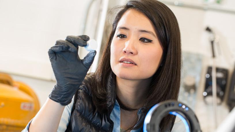
Shiho Kawashima (Photo by Timothy Lee Photographers)
Unchecked, the cost of climate change could severely impact a city’s bottom line. This is particularly true for the vast majority of urban centers that sit near coastal areas. A new methodology using Lower Manhattan as a test case is being designed to compute the optimal protective strategy for buffering coastal infrastructure subject to storm surge combined with rise in sea level. Developed by civil engineer George Deodatis, optimization expert Daniel Bienstock, and applied mathematician Kyle Mandli, this smart decision scheme factors in prescribed budgets to help municipalities consider various measures—including seawalls, artificial islands/reefs, wetland restoration, raising infrastructure, strategic retreat, and others—in order to implement solutions that are ultimately cheaper than taking no action.
To ensure long-term sustainability, cutting emissions remains another crucial piece of the climate-proofing equation. Today, between 5 percent and 8 percent of man-made carbon emissions derive from cement manufacturing. Burning enough current raw material—typically, quarried limestone—to produce one ton of cement also releases one ton of CO2.
In a bid to dramatically increase the sustainability of our infrastructure’s core building blocks, Shiho Kawashima, associate professor of civil engineering, investigates new manufacturing techniques for alternative binders—building a new intelligence into the system from the ground up.
In her search for abundant, inexpensive, sustainable alternatives to source raw materials for clinkers and binders, Kawashima is collaborating with colleagues from the chemical engineering department. Associate Professor Daniel Esposito is developing a technique for electrochemically harvesting metal hydroxides from seawater, which can replace cement and significantly reduce the CO2 associated with concrete.
With Ah-Hyung (Alissa) Park, an associate professor in both earth and environmental engineering and chemical engineering as well as director of the Lenfest Center for Sustainable Energy, Kawashima is also examining techniques to utilize materials derived from upcycling of wastes and carbon sequestration as alternative binders.
Ultimately, the kind of convergence illustrated in each of these projects is precisely what leads to smarter outcomes, by marrying a specific vision with diverse strategies and a flexible approach—one that respects natural resources while balancing the needs of government, industry, and communities.
“You don’t create technology just to have technology,” says Culligan. “You create technology to serve people. Our school’s vision for smarter cities is one that aims to improve the lives of urban inhabitants.”
Using data to engineer smarter urban spaces
